
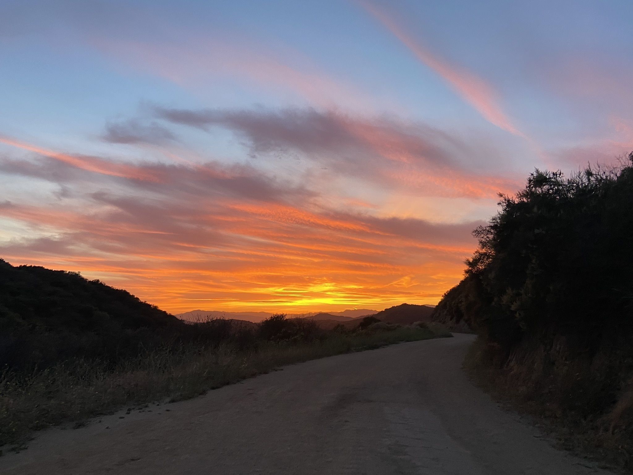
Our world has changed since March 2020, in good ways and bad. But one thing that remains largely unchanged? The great outdoors. The many beautiful, meandering hiking trails of Los Angeles are waiting, ready for you to explore, get lost in the wilderness, and maybe even find yourself in the process. If you still aren’t convinced, consider what California’s outdoorsman grandfather once said:
“Few places in this world are more dangerous than home. Fear not, therefore, to try the mountain passes. They will kill care, save you from deadly apathy, set you free, and call forth every faculty into vigorous, enthusiastic action.”
-John Muir
For those Angelenos who grew up here, and other natives in Southern California, the fact that we have amazing hiking opportunities may be lost on you. The reality is that much of the rest of the country simply doesn’t have the terrain we have, the mountains we have, and the waterfalls and rolling hills we can fall in love with time and time again. The beauty of the many hiking trails in LA is not just their variety as a whole, but how different a hike can be in the winter, compared to the summer.
Be sure to wear sunscreen, bring your phone and charge it beforehand, and stay hydrated!
Without further rambling, here are our picks for great hiking trails in Los Angeles:
Easy Hikes
If you are looking for a leisurely hike that won’t leave you sweating through your shirt and gasping for breath, these trails are for you:
1. Solstice Canyon 3.0 mile Loop
3455 Solstice Canyon Rd.
Malibu, CA 90265
Pepperdine students, graduates, professors, and staff likely know about Solstice, a loop near the University. Notable features include the Tropical Terrace (a home that has been burned and rebuilt multiple times in the 20th century) remains, a waterfall, and a plateau on Rising Sun Trail.
2. Mount Hollywood 2.9 miles Out and Back
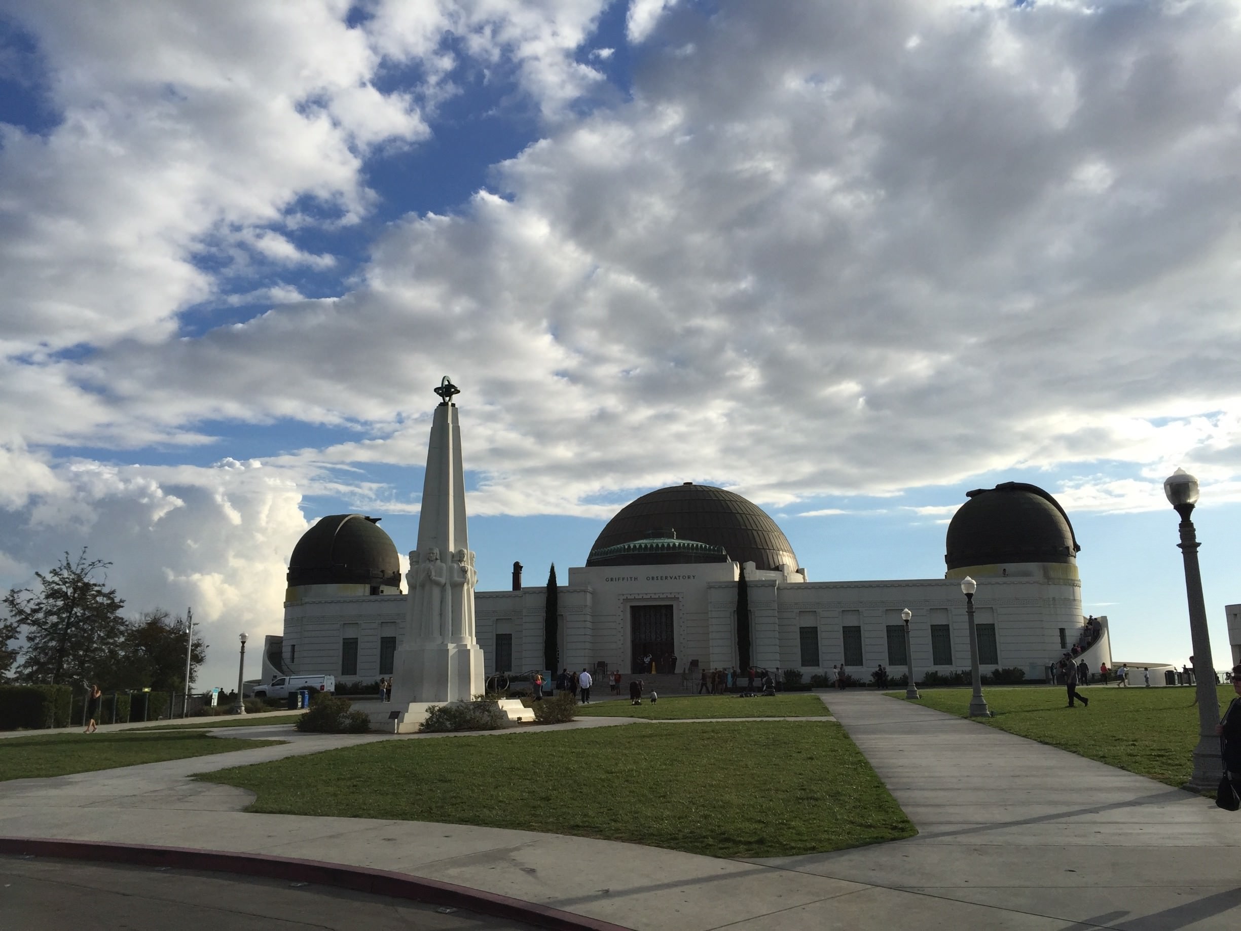
2800 E. Observatory Rd.
Los Angeles, CA 90027
This hike begins in the Griffith Observatory parking lot, with views of Griffith Park, the Hollywood sign, San Fernando Valley, and Downtown Los Angeles among others. *Note: the Griffith Observatory is temporarily closed, and will reopen December 31, 2020.
3. Caballero Canyon 3.4 miles Out and Back
4040 Reseda Blvd.
Tarzana, CA 91356
This out and back trail in Tarzana is a great starter hike. Through the green hills, you climb gradually up the hillside until you reach an unpaved stretch of Mullholland Drive, complete with a bench and a view.
4. Runyon Canyon 3.0 miles Out and Back
2000 N Fuller
Los Angeles, CA 90046
Runyon is the place everyone outside of California thinks Angelenos visit on a regular basis. It is the quintessential celebrity hike and an uber-popular one at that. *As of Dec 29, 2020, the East Trail is closed, while the West Trail loop travels one-way from south to north. Like many other trails on this list, it is also subject to capacity limitations. *
5. Getty View Trail 3.0 miles Out and Back
1394 Casiano Road
Los Angeles, CA 90077
The Getty View trail is where the bougie hikers get their fix. You’ll be privy to views of the freeway traffic and the Getty Center on the opposite side.
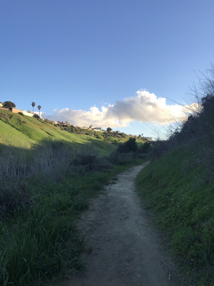
6. O’Melveny Park 3.1 mile Loop
17300 Sesnon Blvd.
Granada Hills, CA 91344
This glorious hike contains a great view of the San Fernando Valley, complete with a reservoir and taller mountaintops in the distance. Given the lack of shade this a hike that’s best tackled in cooler months, early in the day, or late in the day to avoid the heat.
7. Portuguese Bend Reserve 3.0 mile Loop
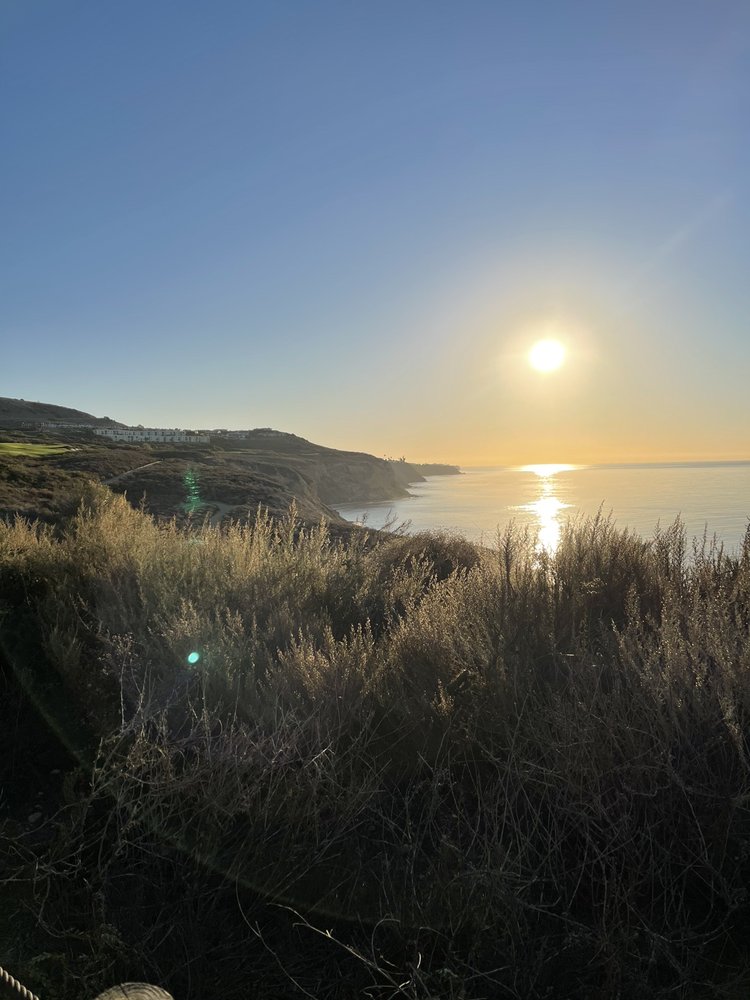
Near Del Cerro Park at the end of Crenshaw Blvd.
Rancho Palos Verdes, CA 90275
Boasting 399 acres, the Portuguese Bend Reserve was preserved in 2005 and also has the distinction of being the largest of the 10 reserves that make up the Palos Verdes Nature Preserve. It delivers phenomenal views of the Pacific Ocean and two notable rare birds: the California gnatcatcher and coastal cactus wren.
8. Fryman Canyon Park 2.55 mile Loop
8401 Mulholland Dr.
Studio City, CA 91604
The 122-acre Fryman Canyon Park offers plenty of native chaparral, year-round springs, and wooded canyons. A plus for some hikers is that no mountain bikers are allowed on the Dearing Trail!
9. Los Liones Trail 4.4 miles Out and Back
580 Los Liones Drive
Pacific Palisades, CA 90272
On the south end of Topanga State Park lies the Los Liones Trail. It weaves up a lush canyon less than a mile from the Pacific Ocean with gorgeous views of the Santa Monica Bay.
10. Kenneth Hahn State Recreation Area
2.2 miles Out and Back
4100 S. La Cienega Blvd.
Los Angeles, CA 90056
This massive space spans 401 acres and includes great views of Century City, Downtown, and the San Gabriel mountains in the distance. There is a wide variety of footpaths to explore here, but the Burke Roche Trail will give you the 2.2-mile distance out and back to jumpstart your hiking adventures.
Intermediate Trails
The following trails deliver lovely views and a solid cardiovascular workout without leaving you on the couch struggling to move.
1. Rustic Canyon to Murphy Ranch Park
3.3+ mile Loop
1562 Casale Rd.
Pacific Palisades, CA 90272
There’s some added mystique to this trail, which includes a hole in a fence, a 529-stair descent, and the graffiti-covered, fenced-off remains of the eponymous Murphy Ranch. What’s the rub? Murphy Ranch was an encampment that Nazi sympathizers constructed during WWII.
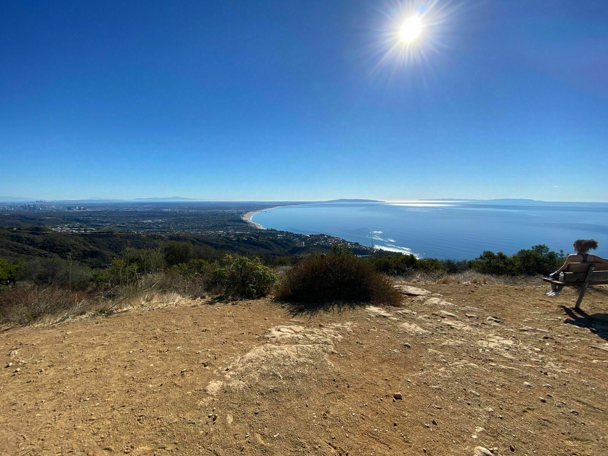
2. Zuma Canyon Trail Ocean View
3.1 mile Loop
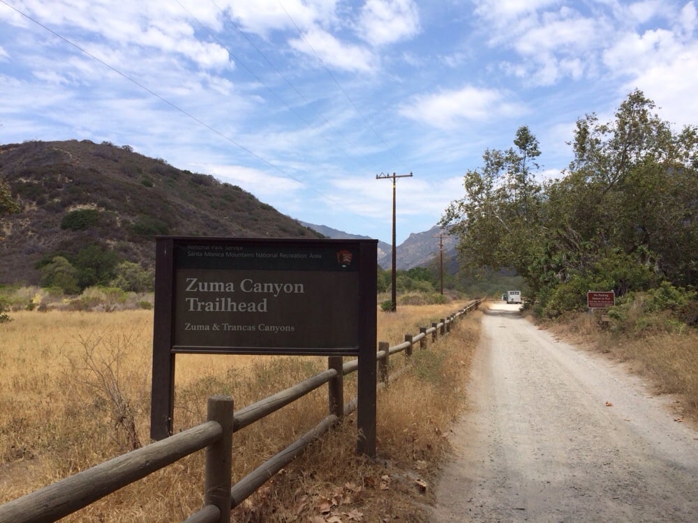
5875 Bonsall Dr.
Malibu, CA 90265
Though this trail is just a mile from Pacific Coast Highway, it feels more remote, complete with lizards, chaparral, and a moderately step climb. Enjoy views of PCH and the Pacific Ocean in the distance.
3. Victory Trailhead 5.1 mile Loop
Victory Blvd. and Gilmore St.
West Hilla, CA 91307
After parking in the $3 gravel lot, experience the joys of this hike, including abundant beautiful wildflowers. The trails are open to hikers, mountain bikers, and equestrians during daylight hours and include wonderful views of unspoiled California landscapes.
4. Bee Rock (Old Zoo Hike) 4.0 mile Loop
4730 Crystal Springs Dr.
Los Angeles, CA 90027
Boasting 823 ft. in elevation gain, the Bee Rock loop weaves its way through the remnants of the Old LA Zoo. You’ll navigate rocks, logs, and duck tree branches as you experience views of the Wilson Golf Course and Verdugo mountain range in the distance.
5. Rivas Canyon Trail 4.2 miles Out and Back
1501 Will Rogers Park Road
Pacific Palisades, CA 90272
A healthy canopy ensures you won’t roast on hot days during this hike. Gorgeous views are the name of the game at Rivas. Get there early to experience that “above the clouds” feeling of the marine layer below you.
6. Eagle Rock Hike 5.4 miles Out and Back
20828 Entrada Rd.
Topanga, CA 90290
Not to be confused with the city of the same name the Eagle Rock hike is nestled in Topanga State Park, and requires $10 for parking at the Trippet Ranch parking lot. It provides fantastic views of the Santa Monica Mountains and they get better the higher you go, provided you are comfortable with heights.
7. Kenter Canyon Hike 4.2 miles Out and Back
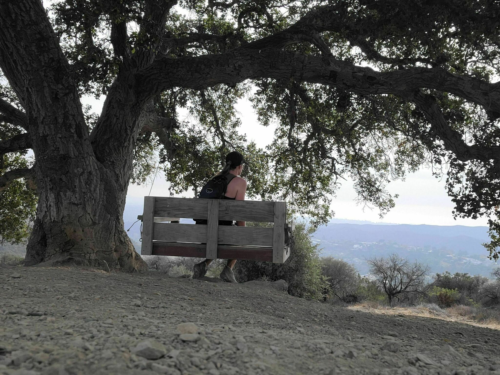
1567 N. Kenter Ave.
Los Angeles, CA 90049
The swing under the shade of a tree serves as an added incentive to hoof it to the end of the Kenter Canyon hike. Pass numerous beautiful homes in Brentwood on your way to the trailhead.
8. Temescal Canyon Hike 3.65 mile Loop
15601 Sunset Blvd.
Pacific Palisades, CA 90272
Temescal belongs in Pacific Palisades, evidenced by the waterfall, $7 parking lot, and immaculate bathrooms at the base. You’ll enjoy wonderful views of the Santa Monica bay as well as Westwood and Downtown Los Angeles on clear days.
Difficult Hikes
1. Echo Mountain Hike via the Sam Merrill Trail 5.8 miles Out and Back
E. Loma Alta Dr. at Lake Ave
Altadena, CA 91001
There are rich views galore on this trail, including Pasadena and the San Gabriel Valley. Plus, you’ll be privy to the rusted remains of the Mt. Lowe Railway — a funicular that rose to a mountainside resort. If you make it all the way to Inspiration Point, you’ll find an array of telescopes that are painted with what you can spot on a clear day (pictured above).
2. Mount Lee & The Hollywood Sign via Brush Canyon Trail 6.1 miles Out and Back
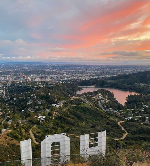
3200 Canyon Dr.
Los Angeles, CA 90068
This is a quintessential Los Angeles hike — one that is certainly worthy of the Gram. Experience sensational views of Griffith Park backcountry and Forest Lawn Cemetery. You’ll even see Lake Hollywood Reservoir and if you persevere you can look down to see the Hollywood sign in all its glory.
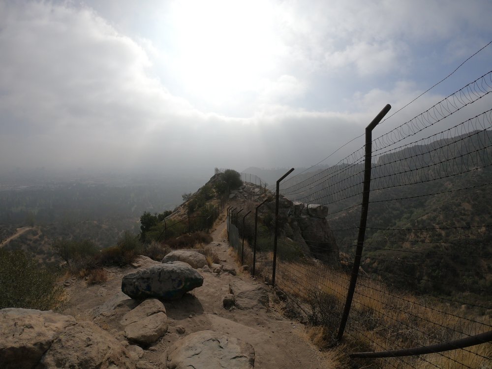
3. Beaudry Motorway Loop Hike
6.15 mile Loop
1300 Beaudry Blvd.
Glendale, CA 91208
This hike has an inauspicious beginning in residential Glendale at the intersection of Beaudry Drive and Beaudry Terrace. Majestic views await you, including the San Fernando Valley, the expanse of the Oakmont Country Club golf course, and the Pacific Ocean.
4. The Bridge to Nowhere
10 miles Out and Back
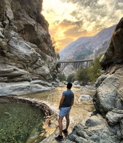
Camp Bonita Road
Azusa, CA 91702
As can be expected in the difficult range of hikes, a USDA Forest Service Adventure Pass is your friend here, granting you parking access at the trailhead, which is situated at the end of Camp Bonita Road in the San Gabriel Mountains above Azusa. Though this hike is not particularly challenging as far as elevation or obstacles, the distance presents the greatest test. The hike gets its name from the bridge that was built in 1936 to connect the San Gabriel Valley with Wrightwood, but a flood two years later washed away that road — and the initiative with it. It remains, stretching across the canyon and serving as one of LA County’s most popular spots for bungee jumping.
5. Hostetter Fire Road to Verdugo Peak Tuna Canyon Hike 7.5 miles Out and Back
La Tuna Canyon Road and W. La Tuna Canyon Road
Sun Valley, CA 91352
Hostetter is a popular trail with mountain bikers, and it also provides terrific views of Downtown LA, the Silverlake Reservoir, Griffith Park, and nearly all of the San Fernando Valley.
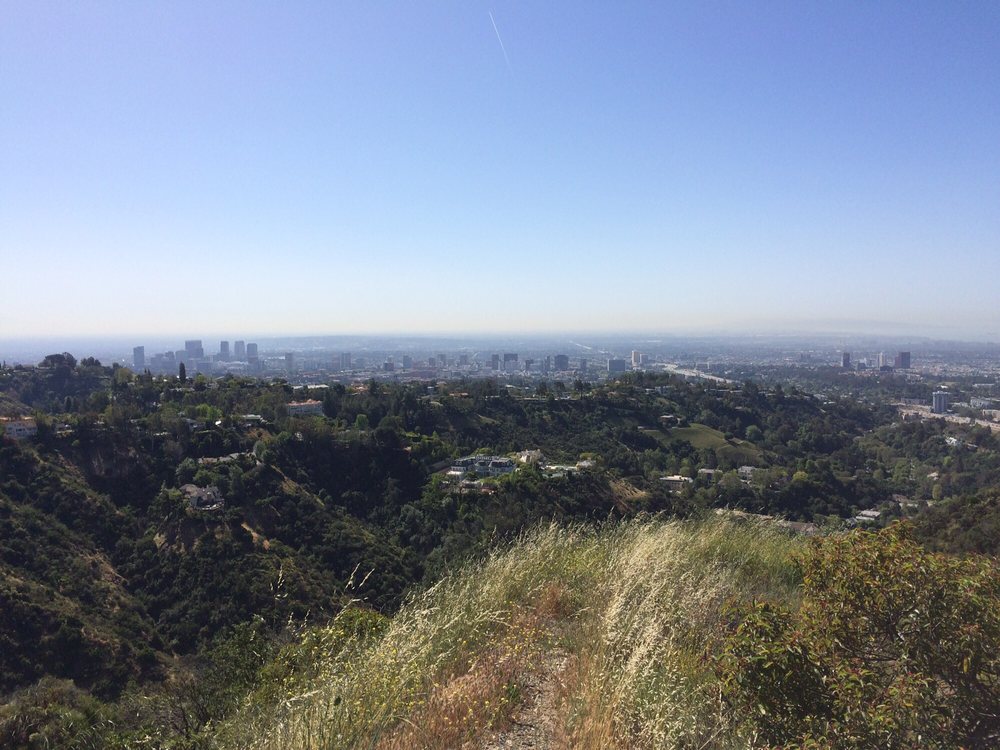
6. Westridge Trail to San Vicente Mountain – Mandeville Canyon Hike 8 miles Out and Back
17500 Mulholland Dr.
Los Angeles, CA 90049
You’ll pass multi-million dollar homes and the Getty Center on your ascent through this trail. As you make your way through the Santa Monica Mountains you’ll see the Pacific Ocean, and (on a clear day) Catalina Island.
7. Parker Mesa Overlook from Trippet Ranch – Topanga State Park 7.5 miles Out and Back
20828 Entrada Rd.
Topanga, CA 90290
This hike begins at the same place as the intermediate Eagle Rock hike, but it is much more robust. Though you won’t find much cover on your way up, the view at the time is divine. Witness the expanse of the Pacific Ocean, Downtown LA, and the San Gabriel Mountains.
Contributor, designer & admin for JohnHart Gazette.